Geolocate

Dharali topographic map

Click on the map to display elevation.

About this map

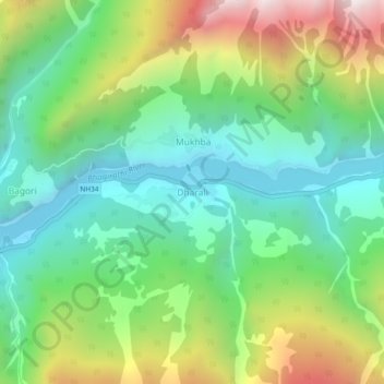
Name: Dharali topographic map, elevation, terrain.

Location: Dharali, Bhatwari, Uttarkashi district, Uttarakhand, India (31.01967 78.75984 31.05967 78.79984)

Average elevation: 2,963 m

Minimum elevation: 2,491 m

Maximum elevation: 3,883 m

Gear up for your next adventure:

🕶️Polarized Sunglasses - Reduces glare from snow and water at high elevations
🧥Waterproof Pants - Keep dry during rainy hiking conditions
💡LED Headlamp - Hands-free illumination for night hiking and camping
Camping Coffee Maker - Brew fresh coffee anywhere on the topographic map
Bushcraft Tarp - Versatile emergency shelter or gear protection

As an Amazon Associate, this site earns from qualifying purchases at no extra cost to you.