Geolocate

Fassfern topographic map

Click on the map to display elevation.

About this map

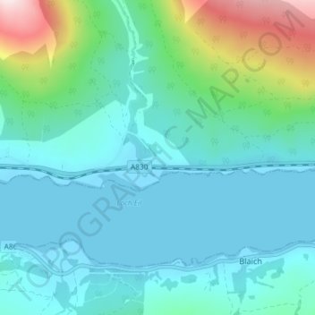
Name: Fassfern topographic map, elevation, terrain.

Location: Fassfern, Highland, Scotland, PH33 7NP, United Kingdom (56.83645 -5.26050 56.87645 -5.22050)

Average elevation: 84 m

Minimum elevation: -2 m

Maximum elevation: 459 m

Gear up for your next adventure:

🕯️Camping Lantern - Illuminates your entire campsite with high-efficiency LEDs
🧴First Aid Kit - Essential first aid supplies for outdoor emergencies
🥾Light Trekking Boots - Supportive boots for multi-day treks
🧥Waterproof Pants - Keep dry during rainy hiking conditions
❄️Traction Ice Cleats - Slip-on spikes for icy trails and winter hiking

As an Amazon Associate, this site earns from qualifying purchases at no extra cost to you.