Eustis topographic map
Interactive map
Click on the map to display elevation.
About this map
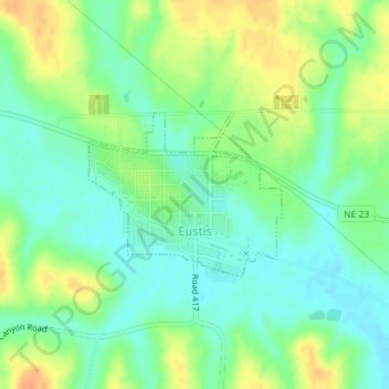
Name: Eustis topographic map, elevation, terrain.
Location: Eustis, Frontier County, Nebraska, 69028, United States (40.65923 -100.03887 40.67068 -100.02119)
Average elevation: 810 m
Minimum elevation: 794 m
Maximum elevation: 833 m
Other topographic maps
Click on a map to view its topography, its elevation and its terrain.
Stockville
United States > Nebraska > Frontier County
Stockville, Frontier County, Nebraska, 69042, United States
Average elevation: 767 m
Curtis
United States > Nebraska > Frontier County
Curtis, Frontier County, Nebraska, 69025, United States
Average elevation: 797 m