Geolocate

Jeori topographic map

Click on the map to display elevation.

About this map

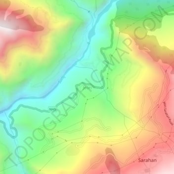
Name: Jeori topographic map, elevation, terrain.

Location: Jeori, Rampur, Shimla, Himachal Pradesh, 172101, India (31.50609 77.75679 31.54609 77.79679)

Average elevation: 1,657 m

Minimum elevation: 1,092 m

Maximum elevation: 2,387 m

Other topographic maps

Click on a map to view its topography, its elevation and its terrain.

Rampur

India > Himachal Pradesh > Rampur

Average elevation: 1,370 m

Gear up for your next adventure:

🥽Outdoor Goggles - Protective eyewear for outdoor activities
🛌Insulated Sleeping Pad - Critical thermal barrier between you and the cold ground
🥾All-Terrain Hiking Boots - Versatile boots for varied hiking conditions
Lightweight Camping Tent - Portable shelter optimized for Canadian backcountry camping
🧴Bear Spray Holster - Quick-access carry for essential Canadian wilderness safety

As an Amazon Associate, this site earns from qualifying purchases at no extra cost to you.