Geolocate

Kalaa topographic map

Click on the map to display elevation.

About this map
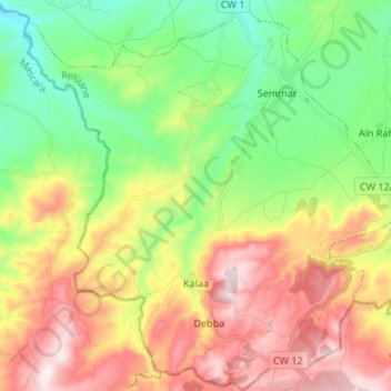
Name: Kalaa topographic map, elevation, terrain.

Location: Kalaa, Yellel District, Relizane, 48000, Algeria (35.55196 0.26969 35.66089 0.39981)

Average elevation: 452 m

Minimum elevation: 186 m

Maximum elevation: 816 m

Gear up for your next adventure:

🛶Kayak Dry Bag - Waterproof storage for kayaking adventures
⛺Bushcraft Tarp - Versatile emergency shelter or gear protection
🐕Hiking Dog Pack - Let your canine companion carry their own water and food
🧴Waterproofing Spray - Restore the DWR coating on jackets and tents
🛰️Satellite Messenger - Emergency communication for areas with no cell service

As an Amazon Associate, this site earns from qualifying purchases at no extra cost to you.