Geolocate

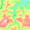
Yanjin County topographic map

Click on the map to display elevation.

About this map

Name: Yanjin County topographic map, elevation, terrain.

Location: Yanjin County, Zhaotong City, Yunnan, China (27.82071 103.98916 28.40540 104.45888)

Average elevation: 1,163 m

Minimum elevation: 336 m

Maximum elevation: 2,439 m

Other topographic maps

Click on a map to view its topography, its elevation and its terrain.

Manan

China > Yunnan > Zhaotong City

Average elevation: 2,343 m

Shashu

China > Yunnan > Zhaotong City

Average elevation: 1,429 m

Gear up for your next adventure:

🥾Mountaineering Boots - Supportive boots for climbing and high-altitude hiking
🥾Lightweight Hiking Boots - Boots for comfort and mobility on long hikes
👟Trail Running Shoes - Agile footwear for fast-paced topographic exploration
🎒Hiking Daypack - Lightweight and durable backpacks for day trips and excursions
🧴Waterproofing Spray - Restore the DWR coating on jackets and tents

As an Amazon Associate, this site earns from qualifying purchases at no extra cost to you.