Geolocate

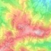
Maranello topographic map

Click on the map to display elevation.

About this map
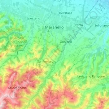
Name: Maranello topographic map, elevation, terrain.

Location: Maranello, Unione dei comuni del Distretto Ceramico, Modena, Emilia-Romagna, 41053, Italy (44.45904 10.82049 44.54737 10.91354)

Average elevation: 221 m

Minimum elevation: 84 m

Maximum elevation: 534 m

Other topographic maps

Click on a map to view its topography, its elevation and its terrain.
Monte Cimone

Italy > Emilia-Romagna > Modena > Fiumalbo

The mountain has an elevation of 2,165 m and is also the highest point in the Emilia-Romagna region of Italy.

Average elevation: 1,759 m
Montombraro

Italy > Emilia-Romagna > Modena

Average elevation: 566 m

Monte della Torraccia

Italy > Emilia-Romagna > Modena > Montese

Average elevation: 923 m

Galleria

Italy > Emilia-Romagna > Modena > Campogalliano

Average elevation: 40 m

Barigazzo

Italy > Emilia-Romagna > Modena

Average elevation: 1,170 m

Pianorso

Italy > Emilia-Romagna > Modena

Average elevation: 846 m

Villanova

Italy > Emilia-Romagna > Modena > Modena

Average elevation: 32 m

Gear up for your next adventure:

🧥Insulated Jacket - Keep warm in cold outdoor conditions
🧴First Aid Kit - Essential first aid supplies for outdoor emergencies
🛰️Satellite Messenger - Emergency communication for areas with no cell service
🧰Multitool Knife - Compact and versatile tool for outdoor use
🛌Down Sleeping Bag - Superior warmth-to-weight ratio for cold nights

As an Amazon Associate, this site earns from qualifying purchases at no extra cost to you.