
Reocín topographic map
Interactive map
Click on the map to display elevation.
About this map
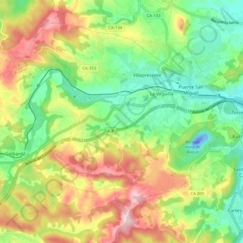
Name: Reocín topographic map, elevation, terrain.
Location: Reocín, Saja-Nansa, Cantabria, España (43.32132 -4.17500 43.37962 -4.07653)
Average elevation: 128 m
Minimum elevation: -45 m
Maximum elevation: 312 m
Other topographic maps
Click on a map to view its topography, its elevation and its terrain.
Puente San Miguel
España > Cantabria > Saja-Nansa > Reocín > Puente San Miguel
Puente San Miguel, Reocín, Saja-Nansa, Cantabria, 39530, España
Average elevation: 69 m