
Champhai topographic map
Interactive map
Click on the map to display elevation.
About this map
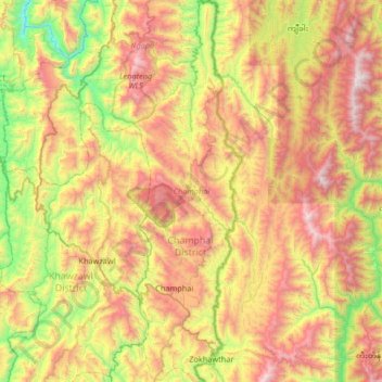
Name: Champhai topographic map, elevation, terrain.
Location: Champhai, Mizoram, 796321, India (23.44742 93.25127 23.93434 93.43737)
Average elevation: 1,157 m
Minimum elevation: 228 m
Maximum elevation: 2,253 m
Other topographic maps
Click on a map to view its topography, its elevation and its terrain.