Geolocate

Lafayette topographic map

Click on the map to display elevation.

About this map

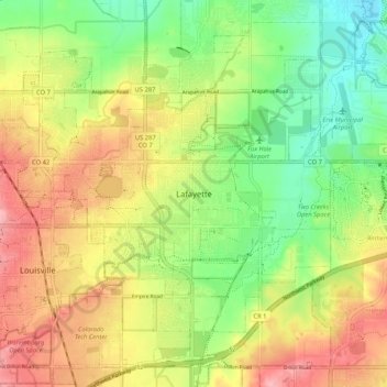
Name: Lafayette topographic map, elevation, terrain.

Location: Lafayette, Boulder County, Colorado, 80026, United States (39.95360 -105.12971 40.03360 -105.04971)

Average elevation: 1,597 m

Minimum elevation: 1,537 m

Maximum elevation: 1,664 m

Gear up for your next adventure:

🧥Waterproof Hiking Jacket - Protect yourself from rain and wind while hiking
🔋Emergency Crank Radio - Weather alerts and power without needing batteries
🧥Waterproof Jacket - Lightweight rain jackets for hiking and outdoor activities
🪜Heavy Duty Carabiners - Multi-use clips for securing gear to your backpack
🥾Trail Hiking Boots - Supportive boots for rough trails

As an Amazon Associate, this site earns from qualifying purchases at no extra cost to you.