
Thank you for supporting this site ❤️
Make a donation
Make a donation
Gear up for your next adventure:
As an Amazon Associate, this site earns from qualifying purchases at no extra cost to you.
Berga topographic map
Click on the map to display elevation.
Thank you for supporting this site ❤️
Make a donation
Make a donation
Gear up for your next adventure:
As an Amazon Associate, this site earns from qualifying purchases at no extra cost to you.
About this map
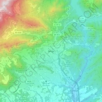
Name: Berga topographic map, elevation, terrain.
Location: Berga, Berguedà, Barcelona, Catalonië, 08600, Spanje (42.06115 1.80548 42.14115 1.88548)
Average elevation: 838 m
Minimum elevation: 473 m
Maximum elevation: 1,938 m
Thank you for supporting this site ❤️
Make a donation
Make a donation
Gear up for your next adventure:
As an Amazon Associate, this site earns from qualifying purchases at no extra cost to you.