
Make a donation
Gear up for your next adventure:
As an Amazon Associate, this site earns from qualifying purchases at no extra cost to you.
Letschin topographic map
Click on the map to display elevation.
Make a donation
Gear up for your next adventure:
As an Amazon Associate, this site earns from qualifying purchases at no extra cost to you.
Letschin
Gemeinden: Alt Tucheband | Beiersdorf-Freudenberg | Bleyen-Genschmar | Bliesdorf | Falkenberg | Falkenhagen (Mark) | Fichtenhöhe | Fredersdorf-Vogelsdorf | Garzau-Garzin | Golzow | Gusow-Platkow | Heckelberg-Brunow | Höhenland | Hoppegarten | Küstriner Vorland | Letschin | Lietzen | Lindendorf | Märkische Höhe | Neuenhagen bei Berlin | Neuhardenberg | Neulewin | Neutrebbin | Oberbarnim | Oderaue | Petershagen/Eggersdorf | Podelzig | Prötzel | Rehfelde | Reichenow-Möglin | Reitwein | Rüdersdorf bei Berlin | Treplin | Vierlinden | Waldsieversdorf | Zechin | Zeschdorf
Make a donation
Gear up for your next adventure:
As an Amazon Associate, this site earns from qualifying purchases at no extra cost to you.
About this map
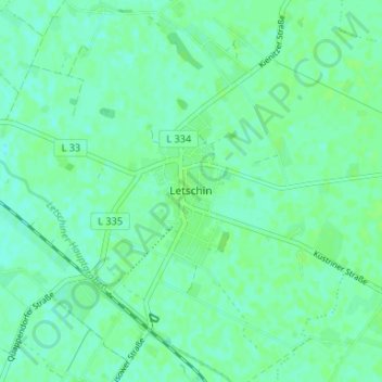
Name: Letschin topographic map, elevation, terrain.
Location: Letschin, Märkisch-Oderland, Brandenburg, 15324, Deutschland (52.62367 14.34176 52.66367 14.38176)
Average elevation: 8 m
Minimum elevation: 4 m
Maximum elevation: 12 m
Make a donation
Gear up for your next adventure:
As an Amazon Associate, this site earns from qualifying purchases at no extra cost to you.