Geolocate

Lancaster topographic map

Click on the map to display elevation.

About this map

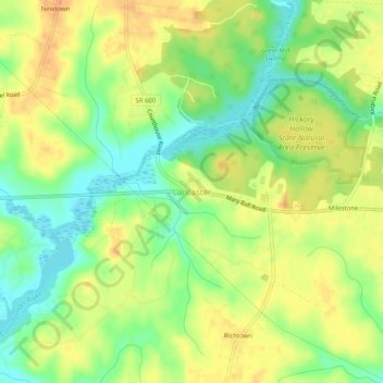
Name: Lancaster topographic map, elevation, terrain.

Location: Lancaster, Lancaster County, Virginia, 22513, United States (37.74986 -76.48634 37.78986 -76.44634)

Average elevation: 20 m

Minimum elevation: 0 m

Maximum elevation: 36 m

Gear up for your next adventure:

🧦Hiking Socks - Moisture-wicking and comfortable socks for long hikes
🧶550 Survival Paracord - Versatile utility cord for emergency repairs and rigging
🧢Sun Protection Cap - Breathable cap to protect from sun exposure
👟Trail Running Shoes - Agile footwear for fast-paced topographic exploration
Camping Groundsheet - Protect your tent from moisture and dirt

As an Amazon Associate, this site earns from qualifying purchases at no extra cost to you.