Geolocate

Chengdou topographic map

Click on the map to display elevation.

About this map

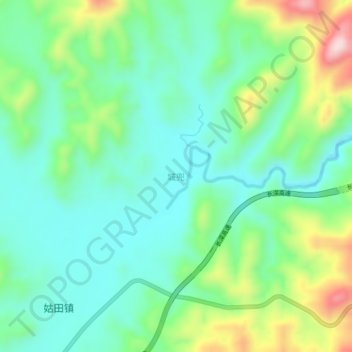
Name: Chengdou topographic map, elevation, terrain.

Location: Chengdou, Longyan City, Fujian, China (25.69054 116.96051 25.73054 117.00051)

Average elevation: 507 m

Minimum elevation: 413 m

Maximum elevation: 735 m

Gear up for your next adventure:

🔦LED Flashlight - Powerful and long-lasting flashlight for camping and emergencies
🌬️Windproof Camp Stove - Efficient cooking even on exposed mountain peaks
🧭GPS Handheld Device - Reliable GPS navigation for outdoor adventures
🩹Compact First Aid Kit - Pre-packed essentials for common trail injuries
🧭GPS Outdoor Watch - Smart watch for navigation and fitness tracking in nature

As an Amazon Associate, this site earns from qualifying purchases at no extra cost to you.