Geolocate

Shirley topographic map

Click on the map to display elevation.

About this map

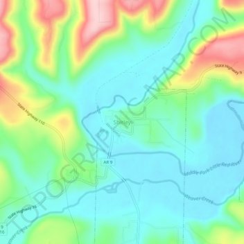
Name: Shirley topographic map, elevation, terrain.

Location: Shirley, Van Buren County, Arkansas, 72153, United States (35.63743 -92.33734 35.67743 -92.29734)

Average elevation: 213 m

Minimum elevation: 152 m

Maximum elevation: 364 m

Gear up for your next adventure:

🦌Outdoor Trail Camera - Monitor wildlife activity near your favorite spots
🧥Thermal Layer - Insulating layer for cold outdoor conditions
🥾Trekking Poles - Adjustable trekking poles to reduce knee stress and improve stability
🎒Hiking Backpack - Lightweight and ergonomic backpacks for day hikes or multi-day treks
🥾Trail Hiking Shoes - Durable shoes designed for rugged trails

As an Amazon Associate, this site earns from qualifying purchases at no extra cost to you.