Geolocate

Bagerque topographic map

Click on the map to display elevation.

Bagerque

Bagergue es el municipio más alto del Valle de Arán, a 1419 m de altitud, situado a la izquierda del río Unhòla, afluente por el margen derecho del río Garona. El núcleo histórico forma parte del Inventario del Patrimonio Arquitectónico de Cataluña. Una carretera que termina en el pueblo desciende hasta Salardú.

About this map
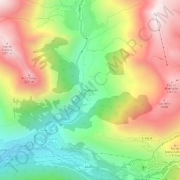
Name: Bagerque topographic map, elevation, terrain.

Location: Bagerque, Alto Arán, Valle de Arán, Lérida, Cataluña, 25539, España (42.69910 0.89619 42.73910 0.93619)

Average elevation: 1,714 m

Minimum elevation: 1,200 m

Maximum elevation: 2,327 m

Gear up for your next adventure:

🛌Down Sleeping Bag - Superior warmth-to-weight ratio for cold nights
🎒Backpack Rain Cover - External shield to keep your entire pack dry
🧴Sunscreen SPF - Broad-spectrum sunscreen for outdoor activities
🕶️Polarized Sunglasses - Protect your eyes with durable polarized lenses
🧢Beanie Hat - Keep your head warm in cold weather

As an Amazon Associate, this site earns from qualifying purchases at no extra cost to you.