Geolocate

Sampeyre topographic map

Click on the map to display elevation.

About this map

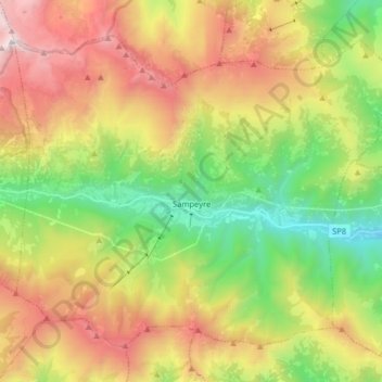
Name: Sampeyre topographic map, elevation, terrain.

Location: Sampeyre, Cuneo, Piedmont, Italy (44.53717 7.11423 44.62988 7.27442)

Average elevation: 1,720 m

Minimum elevation: 752 m

Maximum elevation: 2,981 m

Gear up for your next adventure:

Camping Coffee Maker - Brew fresh coffee anywhere on the topographic map
🩹Compact First Aid Kit - Pre-packed essentials for common trail injuries
🧥Waterproof Jacket - Lightweight rain jackets for hiking and outdoor activities
🎒Backpack Rain Cover - External shield to keep your entire pack dry
🧢Sun Hat - Wide-brim hat for sun protection

As an Amazon Associate, this site earns from qualifying purchases at no extra cost to you.