Geolocate

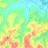
Camobi topographic map

Click on the map to display elevation.

About this map

Name: Camobi topographic map, elevation, terrain.

Location: Camobi, Sede, Santa Maria, Rio Grande do Sul, Região Sul, Brasil (-29.73579 -53.75605 -29.68989 -53.66788)

Average elevation: 98 m

Minimum elevation: 66 m

Maximum elevation: 293 m

Other topographic maps

Click on a map to view its topography, its elevation and its terrain.
Gear up for your next adventure:

💡Solar Camping Lamp - Eco-friendly lighting for campsites
🧢Hiking Hat - Sun-protective and breathable hats for long treks
🥾Durable Hiking Shoes - Long-lasting shoes for frequent hiking
🔋Lithium AA Batteries - Long-lasting power that performs in extreme cold
🪜Heavy Duty Carabiners - Multi-use clips for securing gear to your backpack

As an Amazon Associate, this site earns from qualifying purchases at no extra cost to you.