Make a donation
Gear up for your next adventure:
As an Amazon Associate, this site earns from qualifying purchases at no extra cost to you.
Sausar topographic map
Click on the map to display elevation.
Make a donation
Gear up for your next adventure:
As an Amazon Associate, this site earns from qualifying purchases at no extra cost to you.
Sausar
Sausar is located at 21°39′N 78°47′E / 21.65°N 78.78°E / 21.65; 78.78 in central India. It has an average elevation of 352 metres (1,154 feet). The Jam and Kanhan Rivers are the main rivers in Sausar. The city is situated between the two rivers.
Make a donation
Gear up for your next adventure:
As an Amazon Associate, this site earns from qualifying purchases at no extra cost to you.
About this map
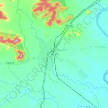
Name: Sausar topographic map, elevation, terrain.
Average elevation: 365 m
Minimum elevation: 326 m
Maximum elevation: 507 m
Make a donation
Gear up for your next adventure:
As an Amazon Associate, this site earns from qualifying purchases at no extra cost to you.
