Geolocate

Taggia topographic map

Click on the map to display elevation.

About this map

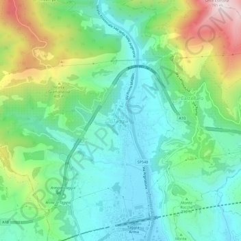
Name: Taggia topographic map, elevation, terrain.

Location: Taggia, Imperia, Liguria, 18018, Italy (43.84144 7.83228 43.88144 7.87228)

Average elevation: 229 m

Minimum elevation: 5 m

Maximum elevation: 775 m

Gear up for your next adventure:

🚲Handlebar Phone Mount - View topographic-map.com live while cycling
🧳Compression Sacks - Maximize space in your backpack by shrinking gear
🛶Waterproof Dry Bags - Keep electronics and clothes dry during river crossings
🧴Waterproofing Spray - Restore the DWR coating on jackets and tents
🧥Softshell Hiking Jacket - The perfect balance of wind protection and breathability

As an Amazon Associate, this site earns from qualifying purchases at no extra cost to you.