
Thank you for supporting this site ❤️
Make a donation
Make a donation
Gear up for your next adventure:
As an Amazon Associate, this site earns from qualifying purchases at no extra cost to you.
Birugo topographic map
Click on the map to display elevation.
Thank you for supporting this site ❤️
Make a donation
Make a donation
Gear up for your next adventure:
As an Amazon Associate, this site earns from qualifying purchases at no extra cost to you.
About this map
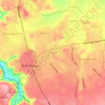
Name: Birugo topographic map, elevation, terrain.
Location: Birugo, Agam Regency, West Sumatra, 26112, Indonesia (-0.32022 100.35809 -0.28022 100.39809)
Average elevation: 909 m
Minimum elevation: 810 m
Maximum elevation: 955 m
Thank you for supporting this site ❤️
Make a donation
Make a donation
Gear up for your next adventure:
As an Amazon Associate, this site earns from qualifying purchases at no extra cost to you.