Geolocate

Bharthana topographic map

Click on the map to display elevation.

About this map

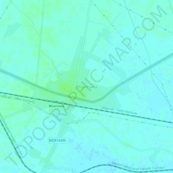
Name: Bharthana topographic map, elevation, terrain.

Location: Bharthana, Etawah, Uttar Pradesh, 206242, India (26.73420 79.20490 26.77420 79.24490)

Average elevation: 147 m

Minimum elevation: 144 m

Maximum elevation: 151 m

Gear up for your next adventure:

🥾Waterproof Hiking Boots - Essential footwear for rugged terrain and wet Canadian trails
🥾Hiking Leggings - Comfortable leggings for outdoor activities
🧢Hiking Sun Hat - Wide-brimmed protection for exposed mountain ridges
🔥Camping Stove - Portable stoves to cook outdoors with ease
🥾Trail Running Boots - Durable shoes designed for trail running

As an Amazon Associate, this site earns from qualifying purchases at no extra cost to you.