
Kankakee County topographic map
Interactive map
Click on the map to display elevation.
About this map
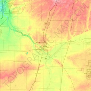
Name: Kankakee County topographic map, elevation, terrain.
Location: Kankakee County, Illinois, États-Unis d'Amérique (40.99455 -88.25143 41.29807 -87.52618)
Average elevation: 201 m
Minimum elevation: 154 m
Maximum elevation: 254 m
Other topographic maps
Click on a map to view its topography, its elevation and its terrain.
St. Anne
États-Unis d'Amérique > Illinois > Kankakee County
St. Anne, Kankakee County, Illinois, États-Unis d'Amérique
Average elevation: 200 m