
Make a donation
Gear up for your next adventure:
As an Amazon Associate, this site earns from qualifying purchases at no extra cost to you.
Beatty topographic map
Click on the map to display elevation.
Make a donation
Gear up for your next adventure:
As an Amazon Associate, this site earns from qualifying purchases at no extra cost to you.
About this map
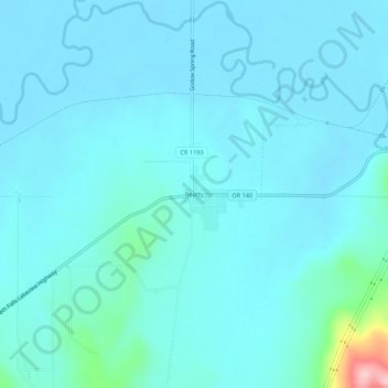
Name: Beatty topographic map, elevation, terrain.
Location: Beatty, Klamath County, Oregon, 97602, United States (42.42196 -121.29093 42.46196 -121.25093)
Average elevation: 1,330 m
Minimum elevation: 1,311 m
Maximum elevation: 1,497 m
Make a donation
Gear up for your next adventure:
As an Amazon Associate, this site earns from qualifying purchases at no extra cost to you.
Other topographic maps
Click on a map to view its topography, its elevation and its terrain.
Merrill
United States > Oregon > Klamath County
Merrill is at an elevation of 4,071 feet (1,241 m) in southern Klamath County, near the Oregon–California border. It is along Oregon Route 39 southeast of Klamath Falls and northwest of Tulelake. Lower Klamath Lake and Tule Lake, both in California, are slightly south of Merrill. By highway, the city is 20…
Average elevation: 1,241 m
Malin
United States > Oregon > Klamath County
Malin is at an elevation of 4,062 feet (1,238 m) in southern Klamath County near the Oregon–California border. It is along a spur of Oregon Route 39, southeast of Klamath Falls, east of Merrill, and northeast of Tulelake. Lava Beds National Monument is to the south, nearby in California. By highway, the city…
Average elevation: 1,241 m
Make a donation
Gear up for your next adventure:
As an Amazon Associate, this site earns from qualifying purchases at no extra cost to you.