
Thank you for supporting this site ❤️
Make a donation
Make a donation
Gear up for your next adventure:
As an Amazon Associate, this site earns from qualifying purchases at no extra cost to you.
Kristen topographic map
Click on the map to display elevation.
Thank you for supporting this site ❤️
Make a donation
Make a donation
Gear up for your next adventure:
As an Amazon Associate, this site earns from qualifying purchases at no extra cost to you.
About this map
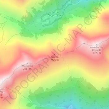
Name: Kristen topographic map, elevation, terrain.
Location: Kristen, Vahrn, Eisacktal, Bozen, Trentino-Südtirol, Italien (46.75377 11.52794 46.75387 11.52804)
Average elevation: 2,181 m
Minimum elevation: 1,767 m
Maximum elevation: 2,570 m
Thank you for supporting this site ❤️
Make a donation
Make a donation
Gear up for your next adventure:
As an Amazon Associate, this site earns from qualifying purchases at no extra cost to you.