Geolocate

Rubí topographic map

Click on the map to display elevation.

About this map

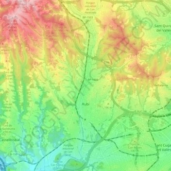
Name: Rubí topographic map, elevation, terrain.

Location: Rubí, Vallès Occidental, Barcelona, Catalonia, 08191, Spain (41.46152 1.97849 41.54337 2.05588)

Average elevation: 187 m

Minimum elevation: 39 m

Maximum elevation: 395 m

Gear up for your next adventure:

🧥Thermal Layer - Insulating layer for cold outdoor conditions
🔥Emergency Fire Starter - Reliable ignition source for all weather conditions
🧦Hiking Liner Socks - Thin base layer to prevent friction and blisters
🥾Light Hiking Boots - Lightweight and comfortable boots for day hikes
💧Hydration Pack - Hands-free hydration system for long hikes

As an Amazon Associate, this site earns from qualifying purchases at no extra cost to you.