Geolocate

Lena topographic map

Click on the map to display elevation.

About this map

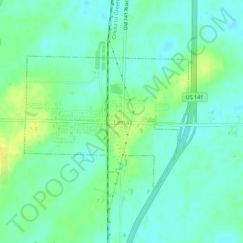
Name: Lena topographic map, elevation, terrain.

Location: Lena, Oconto County, Wisconsin, 54139, United States (44.94385 -88.06225 44.95844 -88.03642)

Average elevation: 214 m

Minimum elevation: 206 m

Maximum elevation: 227 m

Other topographic maps

Click on a map to view its topography, its elevation and its terrain.

Underhill

United States > Wisconsin > Oconto County

Average elevation: 249 m

Townsend

United States > Wisconsin > Oconto County > Townsend

Average elevation: 410 m

Lakewood

United States > Wisconsin > Oconto County

Average elevation: 392 m

Maiden Lake

United States > Wisconsin > Oconto County

Average elevation: 374 m

Trout Lake

United States > Wisconsin > Oconto County

Average elevation: 393 m

Gear up for your next adventure:

🩹Moleskin Blister Pads - Direct protection for painful foot pressure points
🥾Hiking Boots - Sturdy boots providing ankle support and traction on rugged trails
👟Trail Running Shoes - Agile footwear for fast-paced topographic exploration
🎒Hiking Backpack - Lightweight and ergonomic backpacks for day hikes or multi-day treks
🥾Mountain Trail Shoes - High-traction shoes for mountain trails

As an Amazon Associate, this site earns from qualifying purchases at no extra cost to you.