Geolocate

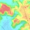
Sangolda topographic map

Click on the map to display elevation.

About this map

Name: Sangolda topographic map, elevation, terrain.

Location: Sangolda, Bardez, North Goa, Goa, 403501, India (15.52543 73.79142 15.56543 73.83142)

Average elevation: 30 m

Minimum elevation: -1 m

Maximum elevation: 83 m

Other topographic maps

Click on a map to view its topography, its elevation and its terrain.

Mapusa

India > Goa > Bardez

Mapusa is located at 15°36′N 73°49′E / 15.60°N 73.82°E / 15.60; 73.82. It has an average elevation of 15 metres (49 feet). It lies on the banks of Mapusa River. Mapusa has a tropical climate with temperatures ranging from a high of 37 °C in summer with high levels of humidity to a low of 21 °C in winters.

Average elevation: 29 m

Anjuna

India > Goa > Bardez > Vagator

Average elevation: 12 m

Pilerne Lake

India > Goa > Bardez > Sangolda

Average elevation: 39 m

Corjuem Fort

India > Goa > Bardez > Corjuem

Average elevation: 13 m

Aguada Fort

India > Goa > Bardez > Sinquerim

Average elevation: 8 m

Anjuna

India > Goa > Bardez

Average elevation: 13 m

Anjuna Beach

India > Goa > Bardez > Anjuna

Average elevation: 10 m

Chapora Fort

India > Goa > Bardez > Chapora

Average elevation: 8 m

Gear up for your next adventure:

🧥Fleece Jacket - Warm and lightweight jacket for layering
🧼Biodegradable Camp Soap - Environmentally friendly cleaning for gear and body
💧Hydration Bladder - Hands-free hydration solution for long treks
🧰Survival Kit - Essential gear for emergencies in the wilderness
🔦UV Flashlight - Detect minerals or specific insects in the dark

As an Amazon Associate, this site earns from qualifying purchases at no extra cost to you.