Geolocate

Montata topographic map

Click on the map to display elevation.

About this map

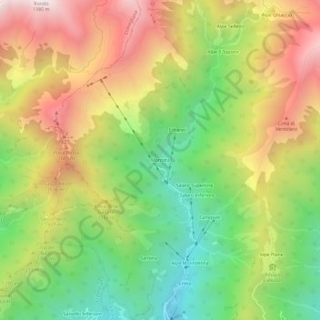
Name: Montata topographic map, elevation, terrain.

Location: Montata, Varallo, Vercelli, Piedmont, Italy (45.85824 8.22132 45.89824 8.26132)

Average elevation: 1,217 m

Minimum elevation: 615 m

Maximum elevation: 1,918 m

Gear up for your next adventure:

💡Solar Camping Lamp - Eco-friendly lighting for campsites
🥾Lightweight Hiking Shoes - Comfortable shoes for day hikes
Lightweight Backpacking Tent - Compact tent for efficient hiking trips
Lightweight Camping Tent - Portable shelter optimized for Canadian backcountry camping
🗺️Topographic Maps - Detailed maps to explore trails, mountains, and wilderness areas

As an Amazon Associate, this site earns from qualifying purchases at no extra cost to you.