Geolocate

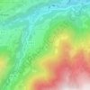
65400 topographic map

Click on the map to display elevation.

About this map

Name: 65400 topographic map, elevation, terrain.

Location: 65400, Arras-en-Lavedan, Argelès-Gazost, Hautes-Pyrénées, Occitanie, France métropolitaine, France (42.81780 -0.32726 43.05296 0.11356)

Average elevation: 1,511 m

Minimum elevation: 351 m

Maximum elevation: 3,265 m

Other topographic maps

Click on a map to view its topography, its elevation and its terrain.
Gear up for your next adventure:

🥾Hiking Shoes - Durable and comfortable shoes for trail hiking
🧦Merino Wool Socks - Moisture-wicking comfort for long-distance hiking
🥾Light Hiking Boots - Lightweight and comfortable boots for day hikes
🧤Insulated Winter Gloves - Heavy-duty protection for sub-zero Canadian adventures
🧰Emergency Multi-Tool - Compact multi-tool for outdoor survival

As an Amazon Associate, this site earns from qualifying purchases at no extra cost to you.