Geolocate

Pachilla topographic map

Click on the map to display elevation.

About this map

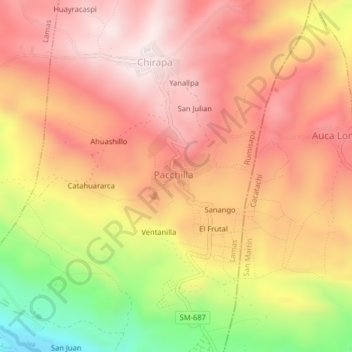
Name: Pachilla topographic map, elevation, terrain.

Location: Pachilla, Rumisapa, Provincia de Lamas, San Martín, Perú (-6.44415 -76.47898 -6.40415 -76.43898)

Average elevation: 708 m

Minimum elevation: 333 m

Maximum elevation: 931 m

Gear up for your next adventure:

🥾Hiking Shoes - Durable and comfortable shoes for trail hiking
🥾Approach Shoes - Shoes designed for climbing approaches and rugged trails
🪑Insulated Seat Pad - Protect your seat from cold rocks and wet logs
🩹Compact First Aid Kit - Pre-packed essentials for common trail injuries
🔋Solar Power Bank - Keep your GPS and devices charged during long outdoor trips

As an Amazon Associate, this site earns from qualifying purchases at no extra cost to you.