Geolocate

Paete topographic map

Click on the map to display elevation.

About this map

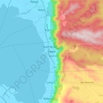
Name: Paete topographic map, elevation, terrain.

Location: Paete, Laguna, Calabarzon, 4016, Philippines (14.32412 121.44158 14.40412 121.52158)

Average elevation: 165 m

Minimum elevation: -3 m

Maximum elevation: 526 m

Other topographic maps

Click on a map to view its topography, its elevation and its terrain.

Ibaba del Norte

Philippines > Laguna > Paete > Ibaba del Sur

Average elevation: 101 m

Gear up for your next adventure:

🔭Compact Monocular - One-handed bird watching and trail spotting
🥾Light Trekking Boots - Supportive boots for multi-day treks
🧴Bear Spray Holster - Quick-access carry for essential Canadian wilderness safety
🛌Down Sleeping Bag - Superior warmth-to-weight ratio for cold nights
🐕Hiking Dog Pack - Let your canine companion carry their own water and food

As an Amazon Associate, this site earns from qualifying purchases at no extra cost to you.