Geolocate

Vaisseries topographic map

Click on the map to display elevation.

About this map
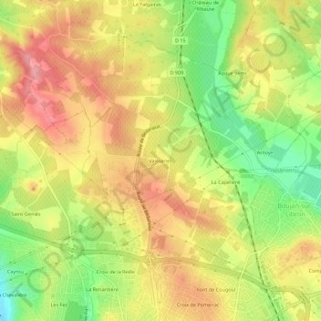
Name: Vaisseries topographic map, elevation, terrain.

Location: Vaisseries, Béziers, Hérault, Occitanie, France métropolitaine, 34500, France (43.35813 3.20524 43.39813 3.24524)

Average elevation: 81 m

Minimum elevation: 17 m

Maximum elevation: 133 m

Other topographic maps

Click on a map to view its topography, its elevation and its terrain.

34500

France > Occitanie > Hérault > Béziers

Average elevation: 43 m

Gear up for your next adventure:

🧤Rechargeable Heated Gloves - Extreme warmth for Canadian winter expeditions
🍽️Titanium Camping Spork - Ultralight and indestructible eating utensil
🛌Down Sleeping Bag - Superior warmth-to-weight ratio for cold nights
🛰️Satellite Messenger - Emergency communication for areas with no cell service
🥾Hiking Shorts - Breathable shorts suitable for summer hikes

As an Amazon Associate, this site earns from qualifying purchases at no extra cost to you.