
Sori topographic map
Interactive map
Click on the map to display elevation.
About this map
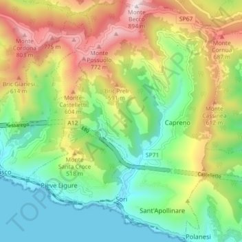
Name: Sori topographic map, elevation, terrain.
Location: Sori, Gênes, Ligurie, Italie (44.36426 9.08885 44.41492 9.13309)
Average elevation: 328 m
Minimum elevation: 0 m
Maximum elevation: 876 m
Other topographic maps
Click on a map to view its topography, its elevation and its terrain.