Geolocate

Buchs (SG) topographic map

Click on the map to display elevation.

About this map

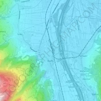
Name: Buchs (SG) topographic map, elevation, terrain.

Location: Buchs (SG), Wahlkreis Werdenberg, St. Gallen, Switzerland (47.13703 9.39773 47.20304 9.50265)

Average elevation: 576 m

Minimum elevation: 436 m

Maximum elevation: 1,715 m

Gear up for your next adventure:

Camping Tent - Weather-resistant tents suitable for 2 to 6 people
🔥Camping Stove - Portable stoves to cook outdoors with ease
🔭Compact Monocular - One-handed bird watching and trail spotting
🔨Vehicle Emergency Tool - Safety tool for remote road trips to trailheads
🧣Merino Neck Gaiter - Protects against wind, sun, and cold at high altitudes

As an Amazon Associate, this site earns from qualifying purchases at no extra cost to you.