
Thank you for supporting this site ❤️
Make a donation
Make a donation
Gear up for your next adventure:
As an Amazon Associate, this site earns from qualifying purchases at no extra cost to you.
Kiambu topographic map
Click on the map to display elevation.
Thank you for supporting this site ❤️
Make a donation
Make a donation
Gear up for your next adventure:
As an Amazon Associate, this site earns from qualifying purchases at no extra cost to you.
About this map
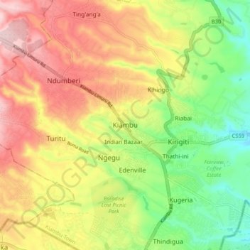
Name: Kiambu topographic map, elevation, terrain.
Location: Kiambu, Central Kenya, 00900, Kenya (-1.20639 36.78528 -1.12639 36.86528)
Average elevation: 1,721 m
Minimum elevation: 1,582 m
Maximum elevation: 1,867 m
Thank you for supporting this site ❤️
Make a donation
Make a donation
Gear up for your next adventure:
As an Amazon Associate, this site earns from qualifying purchases at no extra cost to you.