Geolocate

Kiambu topographic map

Click on the map to display elevation.

About this map

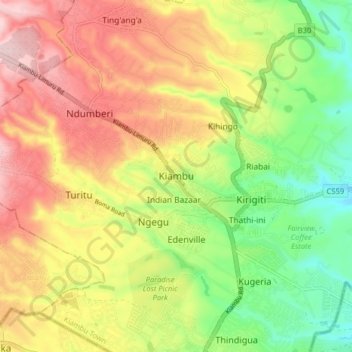
Name: Kiambu topographic map, elevation, terrain.

Location: Kiambu, Central Kenya, 00900, Kenya (-1.20639 36.78528 -1.12639 36.86528)

Average elevation: 1,721 m

Minimum elevation: 1,582 m

Maximum elevation: 1,867 m

Gear up for your next adventure:

🧣Merino Neck Gaiter - Protects against wind, sun, and cold at high altitudes
🥫Freeze-Dried Meals - Lightweight, high-calorie nutrition for multi-day treks
🥾Waterproof Hiking Shoes - Durable shoes for wet and rugged trails
🥤Collapsible Travel Cup - Saves space and weight in your mess kit
🧥Softshell Jacket - Windproof and breathable jacket for hiking

As an Amazon Associate, this site earns from qualifying purchases at no extra cost to you.