
La Garrovilla topographic map
Interactive map
Click on the map to display elevation.
About this map
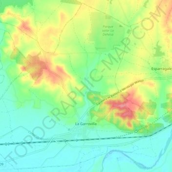
Name: La Garrovilla topographic map, elevation, terrain.
Location: La Garrovilla, Badajoz, Extremadura, 06870, Spain (38.90371 -6.52974 38.97046 -6.44113)
Average elevation: 222 m
Minimum elevation: 194 m
Maximum elevation: 272 m