Geolocate

Tintaine topographic map

Click on the map to display elevation.

About this map
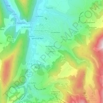
Name: Tintaine topographic map, elevation, terrain.

Location: Tintaine, Villard-de-Lans, Grenoble, Isère, Auvergne-Rhône-Alpes, France métropolitaine, 38250, France (45.04241 5.53731 45.08241 5.57731)

Average elevation: 1,146 m

Minimum elevation: 940 m

Maximum elevation: 1,521 m

Other topographic maps

Click on a map to view its topography, its elevation and its terrain.

Gear up for your next adventure:

🥾Trekking Boots - Durable boots for long-distance trekking
🔦LED Headtorch - Bright and durable light for night activities
🧼Biodegradable Camp Soap - Environmentally friendly cleaning for gear and body
🥾Hiking Shoes - Durable and comfortable shoes for trail hiking
🐕Hiking Dog Pack - Let your canine companion carry their own water and food

As an Amazon Associate, this site earns from qualifying purchases at no extra cost to you.