Meiss Ej-Jabal topographic map
Interactive map
Click on the map to display elevation.
About this map
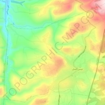
Name: Meiss Ej-Jabal topographic map, elevation, terrain.
Average elevation: 630 m
Minimum elevation: 433 m
Maximum elevation: 855 m

Click on the map to display elevation.
Name: Meiss Ej-Jabal topographic map, elevation, terrain.
Average elevation: 630 m
Minimum elevation: 433 m
Maximum elevation: 855 m