
Make a donation
Gear up for your next adventure:
As an Amazon Associate, this site earns from qualifying purchases at no extra cost to you.
Ham Lake topographic map
Click on the map to display elevation.
Make a donation
Gear up for your next adventure:
As an Amazon Associate, this site earns from qualifying purchases at no extra cost to you.
About this map
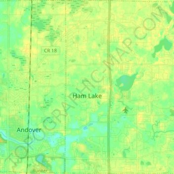
Name: Ham Lake topographic map, elevation, terrain.
Location: Ham Lake, Anoka County, Minnesota, United States (45.21103 -93.26583 45.29816 -93.14226)
Average elevation: 274 m
Minimum elevation: 264 m
Maximum elevation: 283 m
Make a donation
Gear up for your next adventure:
As an Amazon Associate, this site earns from qualifying purchases at no extra cost to you.
Other topographic maps
Click on a map to view its topography, its elevation and its terrain.
Make a donation
Gear up for your next adventure:
As an Amazon Associate, this site earns from qualifying purchases at no extra cost to you.
Rum River North County Park
United States > Minnesota > Anoka County > Saint Francis
Average elevation: 279 m