Geolocate

Ellenton topographic map

Click on the map to display elevation.

About this map

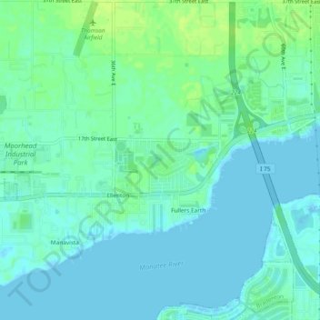
Name: Ellenton topographic map, elevation, terrain.

Location: Ellenton, Manatee County, Florida, United States (27.50552 -82.55195 27.54696 -82.50569)

Average elevation: 5 m

Minimum elevation: -2 m

Maximum elevation: 13 m

Gear up for your next adventure:

💧Hydration Bladder - Hands-free hydration solution for long treks
🥾Waterproof Trail Shoes - Shoes designed to handle wet terrain
🧦Crew Hiking Socks - Comfortable socks for long-distance hikes
🧥Softshell Hiking Jacket - The perfect balance of wind protection and breathability
Lightweight Backpacking Tent - Compact tent for efficient hiking trips

As an Amazon Associate, this site earns from qualifying purchases at no extra cost to you.