Geolocate

Brandon topographic map

Click on the map to display elevation.

About this map

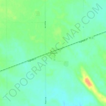
Name: Brandon topographic map, elevation, terrain.

Location: Brandon, Perkins County, Nebraska, United States (40.78333 -101.93240 40.82333 -101.89240)

Average elevation: 1,070 m

Minimum elevation: 1,057 m

Maximum elevation: 1,094 m

Gear up for your next adventure:

🦶Hiking Shoe Insoles - Added support for high arches and long days on feet
🧥Insulated Jacket - Keep warm in cold outdoor conditions
💧Filtered Water Bottle - Safe drinking water on the go
🪜Heavy Duty Carabiners - Multi-use clips for securing gear to your backpack
🔋Lithium AA Batteries - Long-lasting power that performs in extreme cold

As an Amazon Associate, this site earns from qualifying purchases at no extra cost to you.