Geolocate

Dresher topographic map

Click on the map to display elevation.

About this map

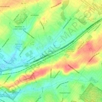
Name: Dresher topographic map, elevation, terrain.

Location: Dresher, Upper Dublin Township, Montgomery County, Pennsylvania, 19025, United States (40.12094 -75.18684 40.16094 -75.14684)

Average elevation: 82 m

Minimum elevation: 52 m

Maximum elevation: 119 m

Other topographic maps

Click on a map to view its topography, its elevation and its terrain.

Gear up for your next adventure:

🧦Crew Hiking Socks - Comfortable socks for long-distance hikes
🧦Thermal Socks - Warm socks for winter hiking or camping
🔦LED Headtorch - Bright and durable light for night activities
🩹Moleskin Blister Pads - Direct protection for painful foot pressure points
🦟Insect Repellent - Keep mosquitoes and black flies away in wooded areas

As an Amazon Associate, this site earns from qualifying purchases at no extra cost to you.