Geolocate

Monte Agner topographic map

Click on the map to display elevation.

About this map
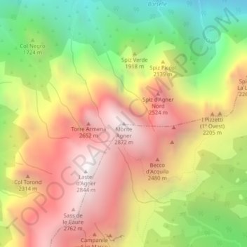
Name: Monte Agner topographic map, elevation, terrain.

Location: Monte Agner, Taibon Agordino, Belluno, Veneto, 32027, Italy (46.27636 11.95266 46.27646 11.95276)

Average elevation: 1,887 m

Minimum elevation: 855 m

Maximum elevation: 2,830 m

Gear up for your next adventure:

🧼Biodegradable Camp Soap - Environmentally friendly cleaning for gear and body
🚑Survival Whistle - Signal for help across long distances in mountains
⛺Backpacking Tent - Lightweight tent for long-distance hiking trips
🛌Down Sleeping Bag - Superior warmth-to-weight ratio for cold nights
🧣Merino Neck Gaiter - Protects against wind, sun, and cold at high altitudes

As an Amazon Associate, this site earns from qualifying purchases at no extra cost to you.