Geolocate

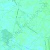
San Nicolas topographic map

Click on the map to display elevation.

About this map

Name: San Nicolas topographic map, elevation, terrain.

Location: San Nicolas, San Pedro, San Luis, Pampanga, Central Luzon, Philippines (15.01185 120.77781 15.02879 120.79811)

Average elevation: 5 m

Minimum elevation: 0 m

Maximum elevation: 9 m

Other topographic maps

Click on a map to view its topography, its elevation and its terrain.

Purok 2

Philippines > Pampanga > San Luis > Santa Monica

Average elevation: 6 m

San Sebastian

Philippines > Pampanga > San Luis

Average elevation: 6 m

Bambang Creek

Philippines > Pampanga > San Luis

Average elevation: 5 m

Purok 5

Philippines > Pampanga > San Luis > San Carlos

Average elevation: 5 m

Gear up for your next adventure:

🥾Hiking Gaiters - Protect legs and shoes from mud, snow, and debris
❄️Traction Ice Cleats - Slip-on spikes for icy trails and winter hiking
🛏️Camping Sleeping Mat - Comfortable mats for sleeping outdoors
🧦Outdoor Socks - Durable socks designed for hiking and outdoor sports
🥾Waterproof Hiking Boots - Boots keeping your feet dry in wet conditions

As an Amazon Associate, this site earns from qualifying purchases at no extra cost to you.