Geolocate

Finocchiara topographic map

Click on the map to display elevation.

About this map

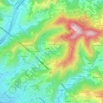
Name: Finocchiara topographic map, elevation, terrain.

Location: Finocchiara, Bassa Val Bisagno, Genoa, Liguria, 16144, Italy (44.40578 8.96414 44.44578 9.00414)

Average elevation: 195 m

Minimum elevation: 8 m

Maximum elevation: 555 m

Other topographic maps

Click on a map to view its topography, its elevation and its terrain.

Spianata dell'Acquasola

Italy > Liguria > Genoa > Genoa

Average elevation: 43 m

Gear up for your next adventure:

🦌Outdoor Trail Camera - Monitor wildlife activity near your favorite spots
Lightweight Camping Tent - Portable shelter optimized for Canadian backcountry camping
🧼Travel Hand Sanitizer - Keep hands clean when water is scarce
🛶Waterproof Dry Bags - Keep electronics and clothes dry during river crossings
💧Filtered Water Bottle - Safe drinking water on the go

As an Amazon Associate, this site earns from qualifying purchases at no extra cost to you.