Geolocate

Ternaard topographic map

Click on the map to display elevation.

About this map

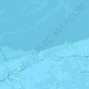
Name: Ternaard topographic map, elevation, terrain.

Location: Ternaard, Noardeast-Fryslân, Frisia, Netherlands (53.36834 5.90922 53.42093 6.02988)

Average elevation: 0 m

Minimum elevation: -4 m

Maximum elevation: 4 m

Other topographic maps

Click on a map to view its topography, its elevation and its terrain.

De Marne

Netherlands > Frisia > Schettens > Viersprong

Average elevation: -1 m

Wolvega

Netherlands > Frisia > Wolvega > Wolvega

Average elevation: 1 m

Leeuwarden

Netherlands > Frisia > Leeuwarden

Average elevation: 0 m

Gear up for your next adventure:

💡LED Headlamp - Hands-free illumination for night hiking and camping
Tent Footprint - Protect tent floor and increase durability
🥾Trekking Boots - Durable boots for long-distance trekking
💧Filtered Water Bottle - Safe drinking water on the go
🧤Insulated Winter Gloves - Heavy-duty protection for sub-zero Canadian adventures

As an Amazon Associate, this site earns from qualifying purchases at no extra cost to you.