Geolocate

Llacuabamba topographic map

Click on the map to display elevation.

About this map

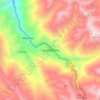
Name: Llacuabamba topographic map, elevation, terrain.

Location: Llacuabamba, Parcoy, Pataz, La Libertad, Perú (-8.07238 -77.49719 -7.99238 -77.41719)

Average elevation: 3,726 m

Minimum elevation: 2,542 m

Maximum elevation: 4,586 m

Gear up for your next adventure:

🚲Bike Repair Kit - Essential tools for on-trail mechanical issues
💧Filtered Water Bottle - Safe drinking water on the go
🥾Mountain Trail Shoes - High-traction shoes for mountain trails
🔦LED Flashlight - Powerful and long-lasting flashlight for camping and emergencies
🥾Light Trekking Boots - Supportive boots for multi-day treks

As an Amazon Associate, this site earns from qualifying purchases at no extra cost to you.