Geolocate

Leland topographic map

Click on the map to display elevation.

About this map

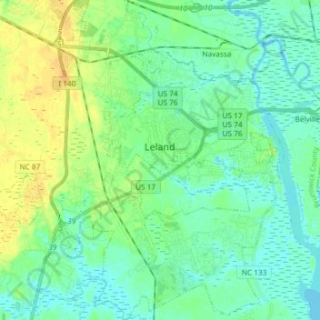
Name: Leland topographic map, elevation, terrain.

Location: Leland, Brunswick County, North Carolina, United States (34.15455 -78.10933 34.27584 -77.98050)

Average elevation: 8 m

Minimum elevation: -2 m

Maximum elevation: 24 m

Other topographic maps

Click on a map to view its topography, its elevation and its terrain.

Gear up for your next adventure:

🩹Compact First Aid Kit - Pre-packed essentials for common trail injuries
Bushcraft Tarp - Versatile emergency shelter or gear protection
🎒Hiking Daypack - Lightweight and durable backpacks for day trips and excursions
🥾Mountain Hiking Boots - High-traction boots for rocky terrain
🍽️Titanium Camping Spork - Ultralight and indestructible eating utensil

As an Amazon Associate, this site earns from qualifying purchases at no extra cost to you.